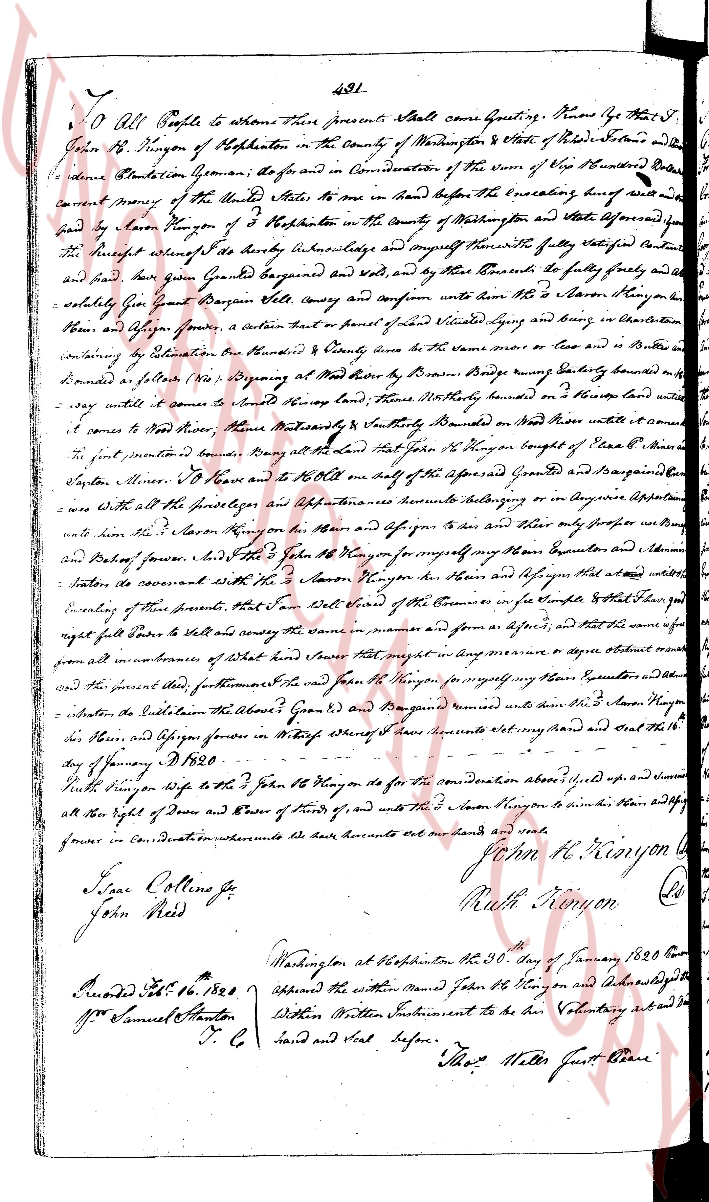
The instrument's own words
page 1
491
To All People to whom these presents shall come Greeting. Know Ye that I
John B. Kenyon of Hopkinton in the County of Washington & State of Rhode Island and the
residence Plantation Geoman; do for and in Consideration of the sum of Five Hundred Dollars
current Money of the United States to me in hand before the executing hereof well and
paid by Jason Kenyon of the town of Hopkinton in the County of Washington and aforesaid for
the receipt whereof I do hereby acknowledge and myself hereafter the fully satisfied and
paid and said given Granted Bargained and Sold, and by these presents do fully give and al-
so release Give Grant Bargain Sell convey and confirm unto the sd Jason Kenyon his
heirs and Assigns forever, a certain part or piece of land situated lying and being in aforesaid
Hopkinton containing ten Bounds to the East by the line of Mrs Case or her Heirs it be
bounded a lotten (no 60) Beginning at the More tree by Brown's Range bound Eastly bounded off
say until it comes to said Kenyon land. Then Northly bounded on the Road land until it com
es to corner to More tree. Then Westwardly bounded by the boundary of Bond on More tree until it com
es to the present boundary. Knowing all the aforesaid land that said Jason B. Kenyon bought of Ezra B.
Dayton Miller. To have and to Hold one half of the aforesaid Granted and Bargained Land
wise with all the Pertinences Appurtenances heretofores belonging or in anywise Appurtenan
ce unto him the sd Jason Kenyon in his heirs and Assigns to him his Heirs and only forever in Buy
and Saleof forever. and I the sd John B. Kenyon do hereby for myself my Heirs Executors and Admin
strators do covenant with the sd Jason Kenyon his Heirs and Assigns that at all times with
Enacting of these presents, that I am Seised in Fee Simple of a Complete Fee and that right
right full Power to Sell and convey the same in manner and form as aforesaid, and that the same is
free from all encumbrances of what nature they might be in any way manner or degree either present
or future and the present land, furthermore I and said John B. Kenyon for myself my Heirs Executors and other
whatsoever to the Esteem the above Given Grd and Bargained remise unto the sd Jason Kenyon
his Heirs and Assigns forever in Witness whereof I have hereunto set my hand and Seal the 16
day of January A D 1820.
Ruth Kenyon Wife to the sd John B. Kenyon by the for consideration above mentioned up and signed
all her Right of dower and Power of funds of, and unto the sd Jason Kenyon to him his Heirs and Assign
forever in Consideration whereunto we have hereunto set our hand and seals
John H. Kenyon
Ruth Kenyon
Isaac Collins jr
John Reid
Washington at Hopkinton the 30th day of January 1820 Cor
Appeared the within named John B. Kenyon and acknowledged the
Within Written Instrument to be his Voluntary act and Deed
hand and Seal before. Thos Miller Justice of the Peace
Recorded Feb 16 1820
Samuel Stanton
T. C
The page as recorded