The instrument's own words
page 1 · read by Gemma vision
56
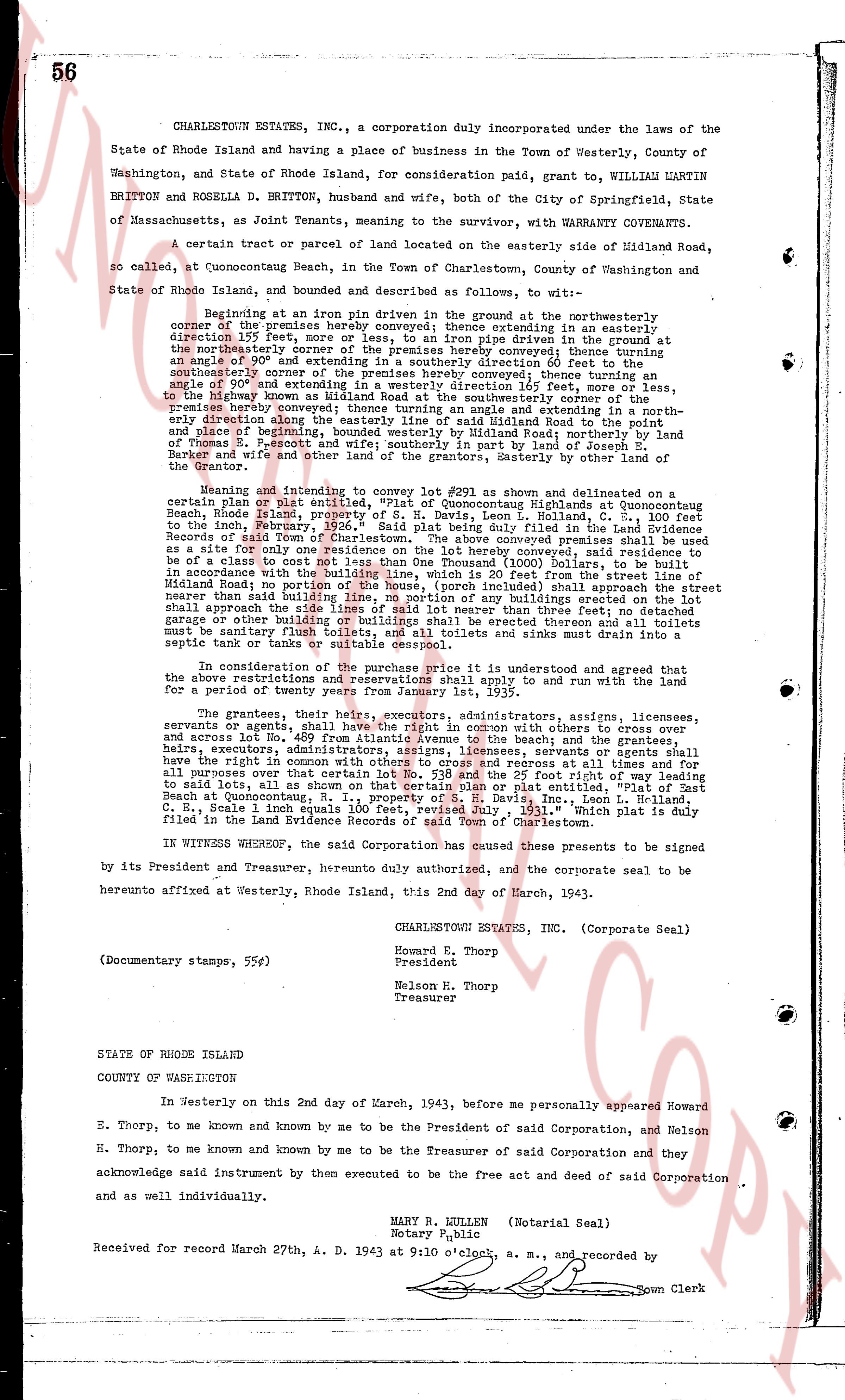
CHARLESTOWN ESTATES, INC., a corporation duly incorporated under the laws of the
State of Rhode Island and having a place of business in the Town of Westerly, County of
Washington, and State of Rhode Island, for consideration paid, grant to, WILLIAM MARTIN
BRITTON and ROSELLA D. BRITTON, husband and wife, both city of the City of Springfield, State
of Massachusetts, as Joint Tenants, meaning to the survivor, with WARRANTY COVENANTS.
A certain tract or parcel of land located on the easterly side of Midland Road,
so called, at Quonochontaug Beach, in the Town of Charlestown of Washington and
State of Rhode Island, and bounded and described as follows, to wit:
Beginning at an iron pin driven in the ground at the northeasterly corner
of the premises hereby conveyed said pin being an easterly extension in an easterly
direction 135 feet, more or less, to an iron pin driven in the ground at the
northeasterly corner of a certain tract of land hereby conveyed running thence in a
angle of 90° and extending in a southerly direction 60 feet 0 inches to the
southeasterly corner of the same tract of land hereby conveyed running thence in a
angle of 90° and extending in a westerly direction 165 feet, more or less,
to the boundary of the land of Joseph E. Scudder, said boundary being the
premises hereby conveyed; thence running an angle and extending in a north-
easterly direction along said boundary to Midland Road to the point of beginning,
bounded westerly by Midland Road; northerly by land of Thomas E.
Britton; easterly by land of Joseph E. Scudder; and southerly by land of Joseph E.
Barker and wife and other land of the grantors. The easterly boundary by their line of
the town of East Hampton.
Meaning and intending to convey lot #293 as shown and delineated on a
certain plan or plat entitled, "Plot of Quonochontaug Highlands at Quonochontaug
Beach, Rhode Island, prepared by David G. Davis, C. E. Roland, in the
town of Charlestown, February 2nd, 1936." Said plan being duly filed in the Land Evidence
Records of said Town of Charlestown. The above conveyed premises shall be used
as a site only for a one family dwelling house; shall not be used for any purpose other
than to be of a class sort with not less than One Thousand ($1000) Dollars, to be built
in accordance with the restrictions of the Corporation and 25 feet from the line of
Midland Road; no portion of the house, (porch included) shall approach the street
nearer than said building line; no building or structure shall be erected, nor shall
approach the side lines of said lot nearer than three feet; no detached garage
or other building shall be erected on said lot unless separated three feet and all toilets
must be sanitary flush toilets, all toilets and sinks must be provided with
septic tanks or suitable cess pools.
The grantees in consideration of the purchase price it is understood and agree that
the above restrictions and reservations shall apply to and run with the land for
a period of twenty years from January 1st, 1935.
The grantees, their heirs, executors, administrators, assigns, licensees,
servants or agents, shall have the right of way, in common with others to cross and
across lot No. 409 from Atlantic Avenue to the beach; and the grantees, their
heirs, executors, administrators, assigns, licensees, servants or agents shall
have the right in common with others to cross and across to reach and at times all
for purposes over the area of lot No. 409 and 25 feet right of way extending
to said lots, as all shown on that certain plan or plat entitled, "Plot of East
Beach at Quonochontaug, Charlestown, R.I. Scale 1 inch equals 100 feet,
C. E. S., Scale 1 inch equals 100 feet, revised July, 1931." which plat is duly
filed in the Land Evidence Records of said Town of Charlestown.
IN WITNESS WHEREOF, the said Corporation has caused these presents to be signed
by its President and Treasurer, hereunto duly authorized, and the corporate seal to be
hereunto affixed at Westerly, Rhode Island, this 2nd day of March, 1943.
CHARLESTOWN ESTATES, INC. (Corporate Seal)
Howard E. Thorp
President
Nelson H. Thorp
Treasurer
(Documentary stamps, 55¢)
STATE OF RHODE ISLAND
COUNTY OF WASHINGTON
In Westerly on this 2nd day of March, 1943, before me personally appeared Howard
E. Thorp, to me known and known by me to be the President of said Corporation, and Nelson
H. Thorp, to me known and known by me to be the Treasurer of said Corporation and they
acknowledge said instrument by then executed to be the free act and deed of said Corporation
and as well individually.
MARY R. MILLER (Notarial Seal)
Notary Public
Received for record March 27th, A. D. 1943 at 9:10 o'clock, a. m., and recorded by
[Signature] Town Clerk
The page as recorded