The instrument's own words
page 1 · read by Gemma vision
178
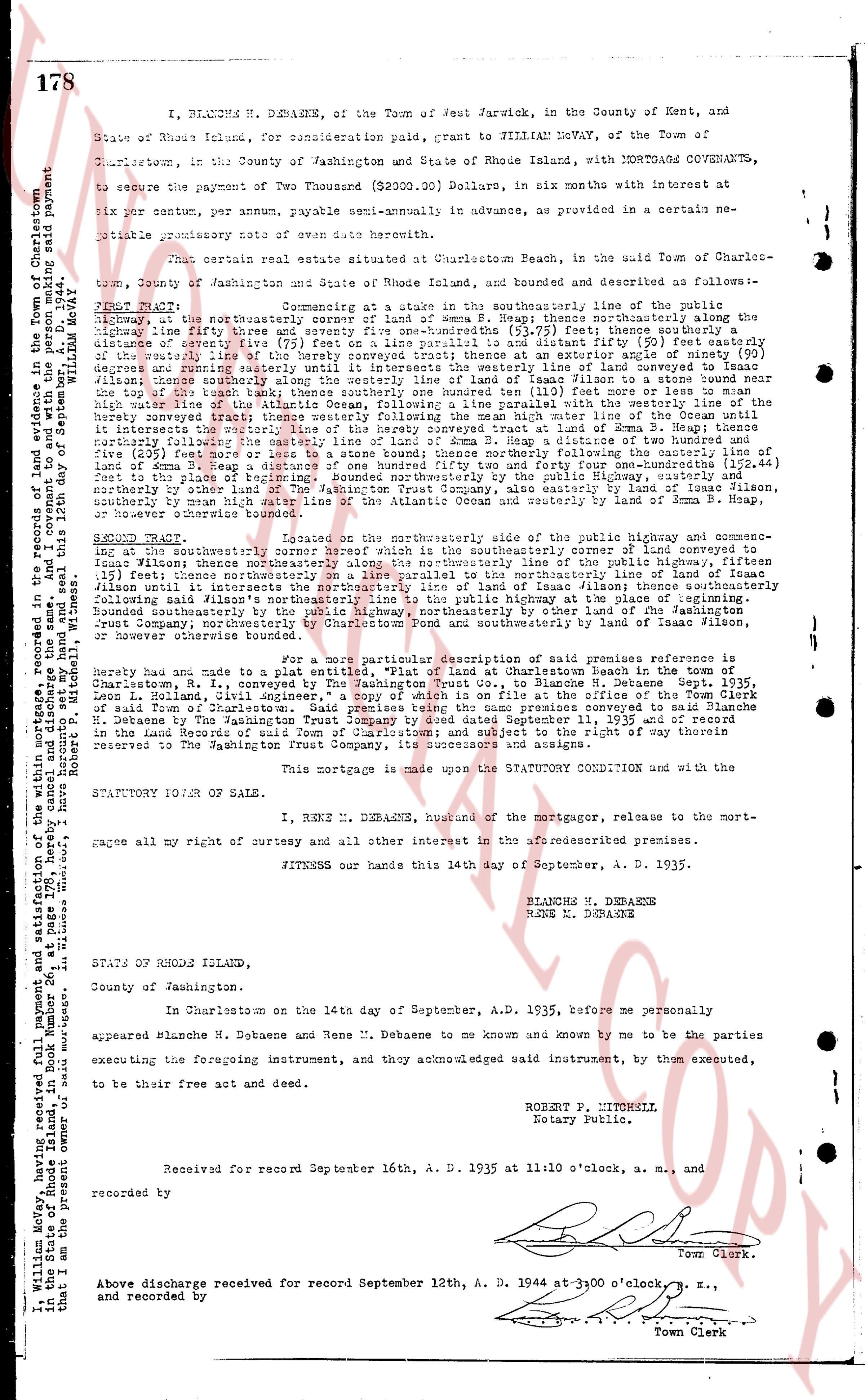
I, BLANCHE M. DEBAENE, of the Town of West Warwick, in the County of Kent, and State of Rhode Island, for consideration paid, grant to WILLIAM MOFEY, of the Town of Charlestown, in the County of Washington and State of Rhode Island, with MORTGAGE COVENANTS, to secure the payment of Two Thousand (2000.00) Dollars, in six months with interest at six per centum per annum, payable semi-annually in advance, as provided in a certain note promissory payable from ore date hereof.
That certain real estate situate at Charlestown Beach, in the said town of Charlestown, Town of Washington and State of Rhode Island, and bounded and described as follows:—
FIRST TRACT: Commencing at a stake in the southerly boundary line of the public highway, at the northeasterly corner of a lot of Emma B. Heap; thence northeasterly along the said highway thirty three and one half (33 1/2) feet to a stone bound; thence southerly a distance of seventy five (75) feet on a line parallel to and distant 75 feet easterly from the said highway; thence westerly seventy five (75) feet to a stone bound; thence northerly 75 degrees and running easterly until it intersects the westerly line of lot conveyed to Isaac Wilson; thence southerly along said line to the southerly boundary line of lot of Emma B. Heap; thence easterly along said boundary line to the stone bound; thence northerly a distance of one hundred ten (110) feet more or less to an iron stake; thence westerly along the high water line of the Atlantic Ocean, following a line parallel with the westerly line of the aforementioned lot of Emma B. Heap, to a stone bound; thence northerly along the line of lot of Emma B. Heap until it intersects the westerly line of the survey conveyed tract at Emma B. Heap; thence easterly along said line to a stone bound; thence northerly along the easterly line of the survey (235) feet more or less to a stone bound; thence northerly following the easterly line of lot of Emma B. Heap to a stone bound; thence easterly along the boundary line of said lot seventy five (75) feet to the place of beginning. Bounded northerly by the public Highway, easterly and southerly by the lot of Emma B. Heap, westerly by the high water line of the Atlantic Ocean, southerly by mean High water line of the Atlantic Ocean and easterly by land of Emma B. Heap, or however otherwise known bounded.
SECOND TRACT: Located on the northerly side of the public highway and commencing at a stone bound, the northerly corner of which is the southeasterly corner of lot conveyed to Isaac Wilson; thence northeasterly along the northeasterly line of lot conveyed to public highway, fifteen feet; thence southerly along the easterly line of lot of Isaac Wilson to the southerly boundary line of Isaac Wilson until it intersects the northeasterly line of land of Isaac Wilson thence southeasterly along said line to a stone bound; thence northerly along the easterly line of lot of Emma B. Heap (235) feet more or less to a stone bound; thence northerly following the easterly line of lot of Emma B. Heap to a stone bound; thence easterly along the boundary line of said lot seventy five (75) feet to the place of beginning. Bounded northerly by the public Highway, northeasterly by other lands of the Washington Trust Company, northeasterly by lot of Emma B. Heap and southerly by land of Isaac Wilson, or however otherwise known bounded.
For a more particular and complete description of said premises reference is hereby made to a plan utitiled, "Plat of land at Charlestown Beach in the town of Charlestown, R. I., conveyed to William Mofey by Blanche M. Debaene" dated September 11, 1935, Leon L. Lowman, civil engineer," a copy of which is on file at the office of the Town Clerk of Charlestown, R. I. and is incorporated herein by reference. The said premises were conveyed to William M. Debaene by The Washington Trust Company by deed dated September 11, 1935 and of record in the land evidence book 24, page 172 of Charlestown, R. I. reserving the right of way southern refers to The Washington Trust Company, its successors and assigns.
This mortgage is made upon the STATUTORY CONDITION and with the STATUTORY POWER OF SALE.
I, RENE M. DEBAENE, husband of the mortgagor, to the mortgage, relent and release all my right of curtesy and all other interest in the aforesaid premises.
WITNESS our hands this 14th day of September, A. D. 1935.
BLANCHE M. DEBAENE
RENE M. DEBAENE
STATE OF RHODE ISLAND,
County of Washington.
In Charlestown on the 14th day of September, A. D. 1935, before me personally appeared Blanche M. Debaene and Rene M. Debaene to me known and by me to be the parties executing the foregoing instrument, and they acknowledged said instrument, by them executed, to be their free act and deed.
ROBERT P. MITCHELL
Notary Public.
Received for record September 16th, A. D. 1935 at 11:30 o'clock, a. m., and recorded by [signature] Town Clerk.
Above discharge received for record September 12th, A. D. 1944 at 3:00 o'clock, p. m., and recorded by [signature] Town Clerk.
[Margin note]: I, William Mofey, having received full payment of and satisfaction of the within mortgage, recorded in the town of Charlestown, R. I. in the State of Rhode Island, in book 24, page 172, hereby cancel and discharge the same and covenant to the preceding said payment that I and the persons under me shall and will warrant the same. Signed, sealed and delivered this 12th day of September, 1944. William Mofey. [signature] Robert P. Mitchell Witness.
The page as recorded