The instrument's own words
page 1 · read by Gemma vision
220
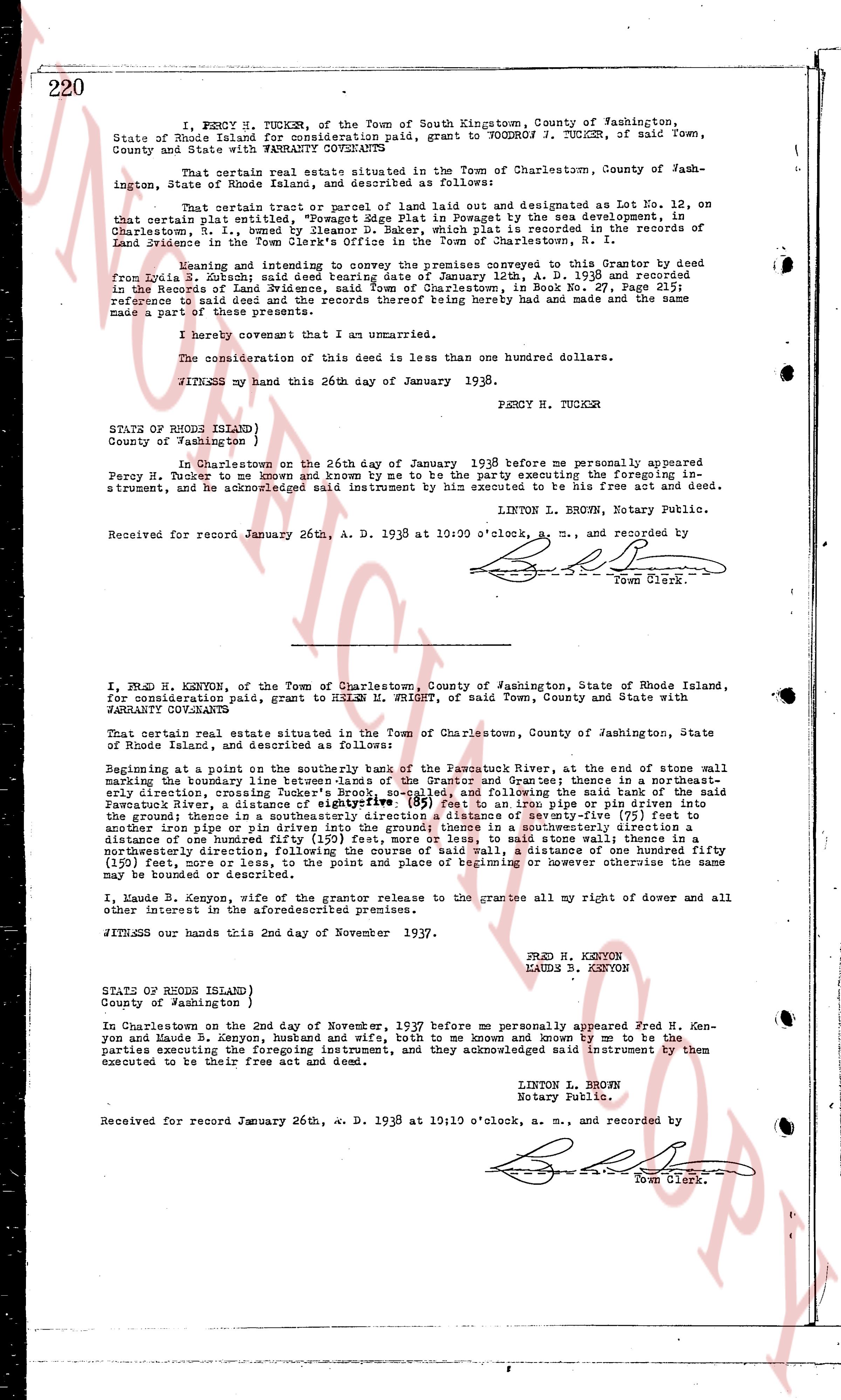
I, PERCY H. TUCKER, of the Town of South Kingstown, County of Washington, State of Rhode Island for consideration paid, grant to WOODROW W. TUCKER, of said Town, County and State with WARRANTY CONVEYANCE
That certain real estate situated in the Town of Charlestown, County of Washington, State of Rhode Island, and described as follows:
That certain real estate, consisting of a parcel of land laid out and designated as Lot No. 12, on that certain plat entitled "Plat of Lot 12" as created by the sea development, in Charlestown, S. I., owned by IllegalArgument D. Baker, which plat is recorded in the Land Evidence of said Town in the Book 21, page 110, Charlestown, R. I.
Meeting and conveying to the present conveyee the premises conveyed to this Grantor by deed from Zoila S. Zobrist said deed bearing date January 12th, A. D. 1936 and recorded in the Land Evidence of said Town in the Book 25, page 110, and the Grantor hereby makes reference to said deed and the records thereof being hereby had and made and the same made a part of these presents.
I hereby covenant that I am an unmarried.
The consideration of this deed is less than one hundred dollars.
WITNESS my hand this 26th day of January 1938.
PERCY H. TUCKER
STATE OF RHODE ISLAND
County of Washington to wit
In Charlestown on the 26th day of January 1938 before me personally appeared Percy H. Tucker to me known and known by me to be the party executing the foregoing instrument to be his free act and deed, instrument, and acknowledged said instrument by him executed to be his free act and deed.
LINTON L. BROWN, Notary Public.
Received for record January 26th, A. D. 1938 at 10:00 o'clock, a. m., and recorded by
[Signature]
Town Clerk.
----
I, FRED H. KENYON, of the Town of Charlestown, County of Washington, State of Rhode Island, for consideration paid, grant to HELEN H. FRIGHT, of said Town, County and State with WARRANTY CONVEYANCE
That certain real estate situated in the Town of Charlestown, County of Washington, State of Rhode Island, and described as follows:
Beginning at a point on the southerly bank of the Pawcatuck River, at the end of some wall marking the boundary line between the lands of the Grantor and grantee; thence in a northeasterly direction, crossing Tucker's Brook, approximately, and following the said bank of the said Pawcatuck River, a distance of eightyfive (85) feet to an iron pipe or pin driven into the ground; thence in a southeasterly direction, a distance of seventy-three (73) feet to another iron pipe or pin driven into the ground; thence in a southwesterly direction a distance of eighty-five (85) feet to the first iron pipe or pin; thence in a southeasterly direction, to said starting point, and thence in a northwesterly direction, following the course of said wall, a distance of one hundred fifty (150) feet to the starting point on the point and place of beginning or however otherwise the same may be bounded or described.
I, Maude B. Kenyon, wife of the grantor release to the grantee all my right of dower and all other interest in the aforesaid premises.
WITNESS our hands this 2nd day of November 1937.
FRED H. KENYON
MAUDE B. KENYON
STATE OF RHODE ISLAND
County of Washington to wit
In Charlestown on the 2nd day of November, 1937 before me personally appeared Fred H. Kenyon and Maude B. Kenyon, husband and wife, both to me known and known by me to be the parties executing the foregoing instrument, and they acknowledged said instrument by them executed to be their free act and deed.
LINTON L. BROWN
Notary Public.
Received for record January 26th, A. D. 1938 at 10:10 o'clock, a. m., and recorded by
[Signature]
Town Clerk.
The page as recorded