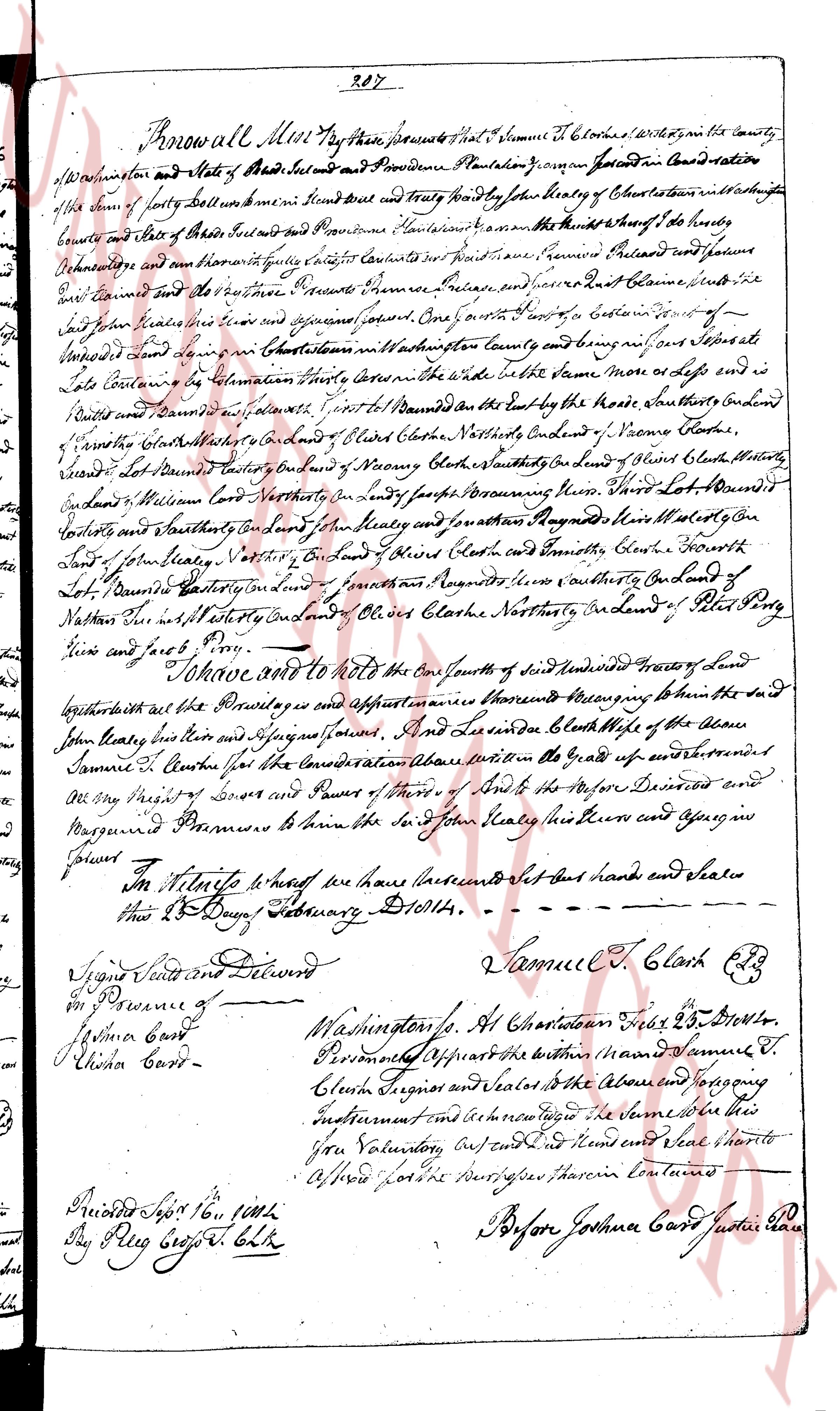
The instrument's own words
page 1
287
Know all Men by these presents That whereas That I, Samuel T. Clarkes with my wife in the county
of Washington state and State of Rhode Island and Providence Plantation Grammar for Consideration of the value
of the sum of forty dollar one American Currency Said Sum and forty find by John Kealy of Charlestown with my wife
Samuel T. Clarkes and wife of these presents and Providence Plantation I convey and assign the whole of my rights
Undivided and the same of my undivided right in the following Lot of Land situated in Charlestown said Lot being bounded on the front
East Landed and the other presents Samuel Clarkes and others East Lande south the
East Land of John Kealy near the road and adjacent parcel One fourth of a rod East of a certain Tree of
Unidentified kind and running West in a Course South West in a Course South West in a Course South West in a Course
Late Landed in Estimation Three rods Corner in the side North the same more or less and
built Landed and bounded and allowed Point to Road bounded on the East by the house where Southward End
of Gorse’s boundary bounded on the South by Land of Clarkes Northward End of Vacant Lot
of Gorse’s boundary bounded on the South by Land of Clarkes Northward End of Vacant Lot
bounded Lot Landed East by Land of Henry Moore’s boundary Southward End of Land
Endland Williams Corner North Westward in any parts bordering the road Their Lot bounded
Eastward and Southward by Land of John Kealy and Southward Northward Westly on the
Lot of John Kealy Northward Eastward on Land of Samuel Clarkes and Eastward Clarkes Northward
Lot bounded Eastward on Land of Samuel Clarkes and Northward Eastward on Land of
Nathaniel Lewis Northward on Land of Oliver Clarkes Northward on Land of Peter Bly
Lewis and faced by Road.
I Release and quit to the said John Kealy a piece of land undivided Three parts of Land of
brother both as the Privilege and appurtenances thereunto belonging measuring to him the said
John Kealy his heirs and Assigns forever. And I release indeed the whole of the share
Samuel T. Clarkes for the consideration above mentioned in the grade of aforesaid
any Right of Survey and Power of Trees of the said to the aforesaid Deceased and
Marguerid Premises to him the said John Kealy his heirs and assigns in
perpetuity.
In Witness whereof we have hereunto set our hand and seal
this 13 Day of January 1814.
Samuel T. Clarkes [seal]
Signed Sealed and Delivered
in Presence of
Joshua Card
Olivia Card
Washington Co. At Charlestown this 13 Day of January
Person Appearing the brother named Samuel T.
Clarkes Signor and Letter to the above and to pray
Instrument and let him read to him
You Voluntarily did and signed and seal shall to
Aforesaid Parties described herein contained
Before Joshua Card Justice of the Peace
The page as recorded