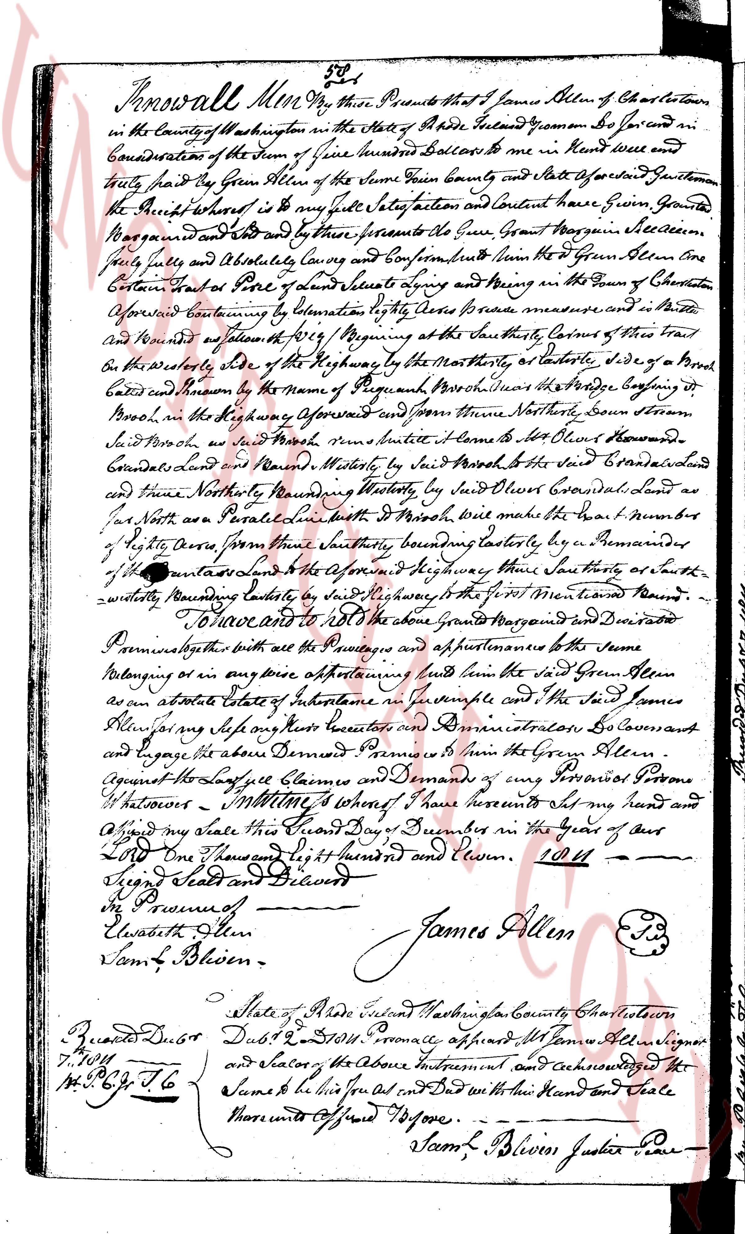
The instrument's own words
page 1
Know all Men by these Presents that I James Boven of Charlestown
in the County of Washington in the State of Rhode Island Geoman Do sell and
assign for and consideration of the Sum of five hundred Dollars to be in Hand received and
truly paid by Gen Allen of the Same Town County and State Foregoing Gentleman
the Right whereas it is my full voluntary Act and Content have Given Granted
Reserved and by these presents do Give Grant Bargain and Sell
fully freely and Absolutely Convey and Confirm unto him Gen Allen alone
Certain Parts of Land and Messuages lying and being in the Town of Charlestown
aforementioned containing by Estimation of the Area precise measure and in Short
and Rounded as follows 1819 / Beginning at the southly Corner of that Tree
on the easterly Side of the Highway by the Northeasterly Side of a Broad
Road known by the Name of the Passage Brook Road where the Bridge is
Brook on the Highway aforesaid and from there Northeasterly Down stream
Said Brook as well as said Brook near home to the Lot of Olon Howard
conveyed Land and Parcel boundedly by said Lot and the said Broad road and
there Northeasterly bounding Westerly by said Olon Howard’s Conoidal land as
far North as Parallel line with Brook will make the distance 1 number of
Rods across from there Northeasterly bounding easterly by a Remainder
of the aforesaid Land to the Aforementioned Highway then Southeasterly as south
westerly bounding Easterly by said highway to the first Mentioned Tree
To Have and to hold the above Grant Bargained and Decreased
Premises together with all the Pertinences and appurtenances belong to the same
belonging or in any way appertaining land unto the said Gen Allen
as an absolute Estate of Inheritance in fee simple and to the said James
Allen’s heirs successors Executor and Administrator’s forever and
convey and bargain the above Demised Premises to him the Gen Allen
against all manner Claims and Demands of any Person or Persons
whatsoever Witness whereof I have hereunto set my hand and
Affixed my seal this Twenty Fourth Day of December in the Year of our
Lord One Thousand Eight hundred and Eleven. 1811
Signed Sealed and Delivered
In Presence of
Elizabeth Allen
Sam L Boven.
James Allen
State of Rhode Island Washington County Charlestown
Presented Decbr 24th 1811. Pronounced affirmed James Allen signatory
and seal of the Above Instrument and acknowledged the
Same to be his Act and Deed with the Hand and Seal
thereunto Affixed before me
Sam L Boven Justice Peace
The page as recorded