The instrument's own words
page 1
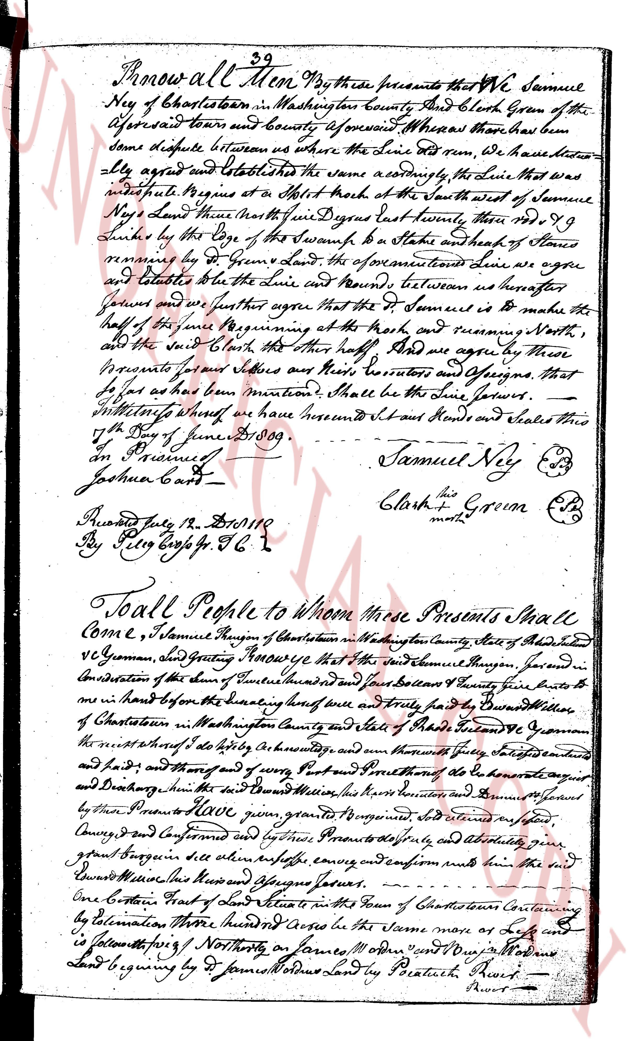
Know all Men By these presents that WE Samuel
Ney of Charlestown in Washington County And Clerk Green of the
aforesaid town and County aforesaid Whereas there has been
some Dispute between us where the Line did run we have since
ly agreed And established the Line as follows namely the Line that was
interrupted Begins at a Split rock at the South west of Samuel
Ney's Land then North one degree Nine Degrees East twenty rods No 99
Links by the Edge of the Swamp to a stake and heap of Stones
removd by Dr Green's Land the aforesaid Line we agree
and Establish be the Line and round between us hereafter
known and we further agree that the Settlement is to make the
half of the same Beginning at the rock and running North,
and the said Clerk the other half And we agree by these
presents for our selves and their Heirs Executors and Assigns that
so far as this has been mentioned Shall be the Line forever.
Witness our hands where we have hereunto Set our Hands and Seales this
the 19th day of June 1809.
Joshua Card
Samuel Ney (seal)
Clerk Green (seal)
[illegible]
Recorded July the 19th 1809
By Peter Boyl Esq J.C.
To all People to whom these Presents Shall
Come I, Samuel Thompson of Charlestown in Washington County State of Rhode Island
and Clerk Green, send Greeting KNOW YE that I the said Samuel Thompson Juror in
consideration of the sum of Three hundred and four Dollars received I grant and
convey and intend hereby and before the designating here of and Truly paid by Edward
of Charlestown in Washington County and state of Rhode Island to Edward Greenman
the messuage and tenement and I do hereby acknowledge and confirm unto me and my heirs
and heirs and theirs and theirs of every Part and tenement of the abo mentioned mess
and Tenement thus in the said Meadows this messuage and tenement is granted and conveyed
by these Presents to Edward Green grant to forever grant and absolutely give
grant Thompson in the above described premises confirm and confirm then the said
Edward Meadows this messuage and premises forever.
One Quarter Part of a piece of land situated in the Town of Charlestown containing
by Estimation Three hundred Acres be the same more or less and
is bounded following Northly on Samuel Moden and Joseph Moden's
Land beginning by d James Moden's Land by Beatrice Amer-
[illegible]
The page as recorded