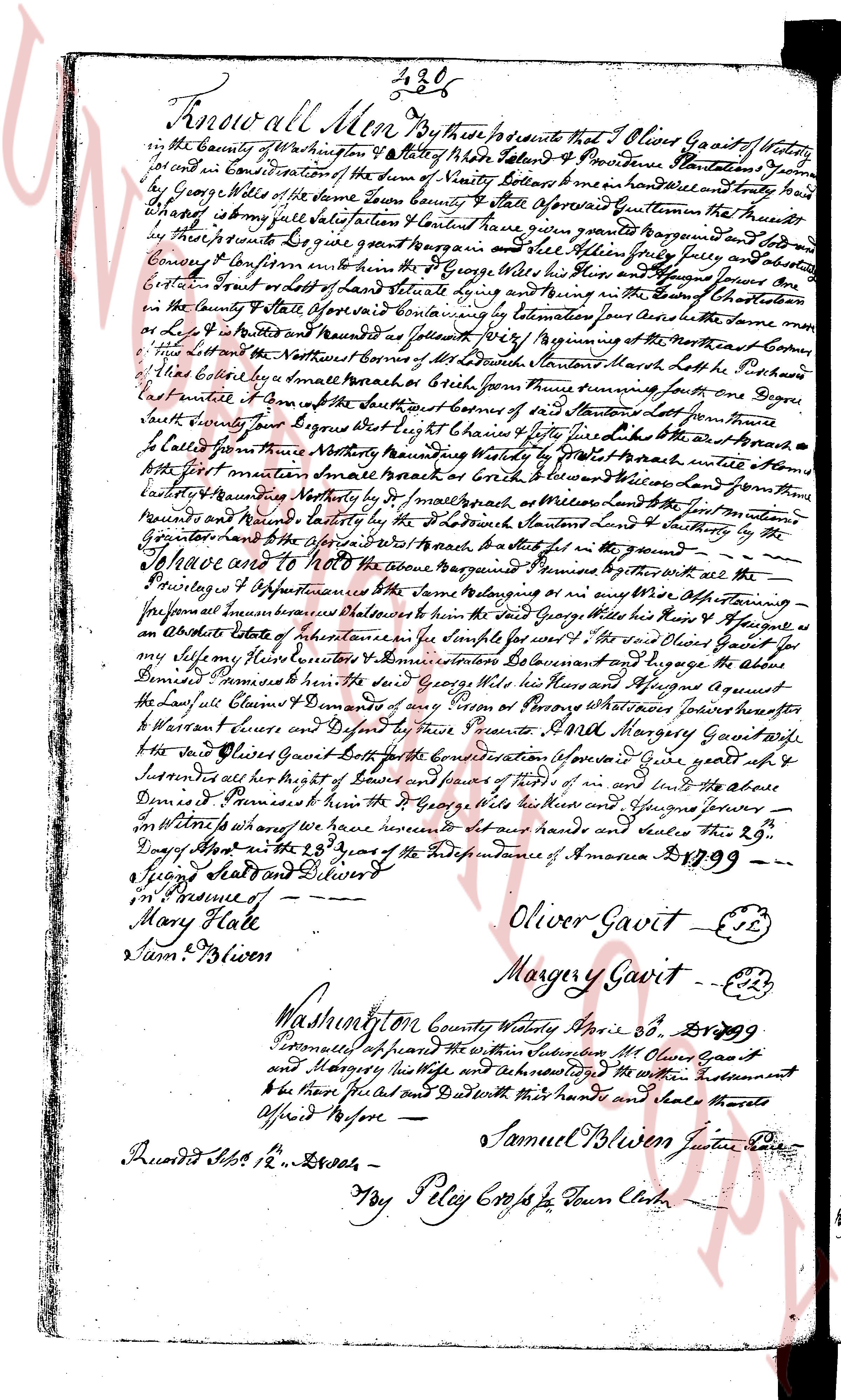
The instrument's own words
page 1
Know all Men by these presents that I Oliver Gavitt of westerly
in the County of Washington State of Rhode Island & Providence Plantations Yeoman
for and in Consideration of the sum of Ninety Dollars & men hundred and twenty four
by George Wilde of the same Town State aforesaid Given quainted that the premises
that I claim by my full Seisure & Satisfaction have I given granted & bargain Sold to
by these presents Do give grant & bargain Sold unto said George Wilde his heirs
Convey & Confirm for ever and also all the Rights & privileges appertaining thereto
and the Bounds of the said Land are as following Viz the Beginning of the premises runs
on the Eastern Bound on the East side of State highway running in the South East corner
in the County State aforesaid Boundary by measurement by the chain the same mea
sure by Lot No 4 bounded and measured as follows Beginning at the Northeast corner of
the Land bounded on the Northeast corner of said Land’s boundary North line to the Pochard
line’s corner then small branch or Brook from thence running East on the Pochard
line’s boundary to the South East corner of the said Land’s boundary then from thence
South boundary line to the East side of State highway then West on the aforesaid
State highway from Northeast boundary to the South West corner’s boundary until it touches
the first mentioned small branch or Brook & then North to the Pochard line’s boundary
thence Northwesterly by the first mentioned small branch or Brook and then from thence
Northwesterly on the Pochard line’s boundary to the first mentioned South boundary & to the
beginning here to the premises which bound & return’s back in the same manner
In Witness whereof I have hereunto set my hand and seal this 29th
day of April in the 23rd year of the Independence of America 1899 --
in Presence of --
Mary Hale
Sam Bliven
Oliver Gavitt (seal)
Margery Gavitt (seal)
Washington County westerly April 29 1899
Personally appeared before me the above named Oliver Gavitt
and Margery his wife and acknowledged the written instrument
to be their free act and deed & did with their hands and seals thereto
affix their seals before me
Samuel Bliven Justice Peace
Duodit 1899 Feb 12’s’ Lawes --
Tey Peley Clerk of Town Clerk
The page as recorded