The instrument's own words
page 1 · read by Gemma vision
586
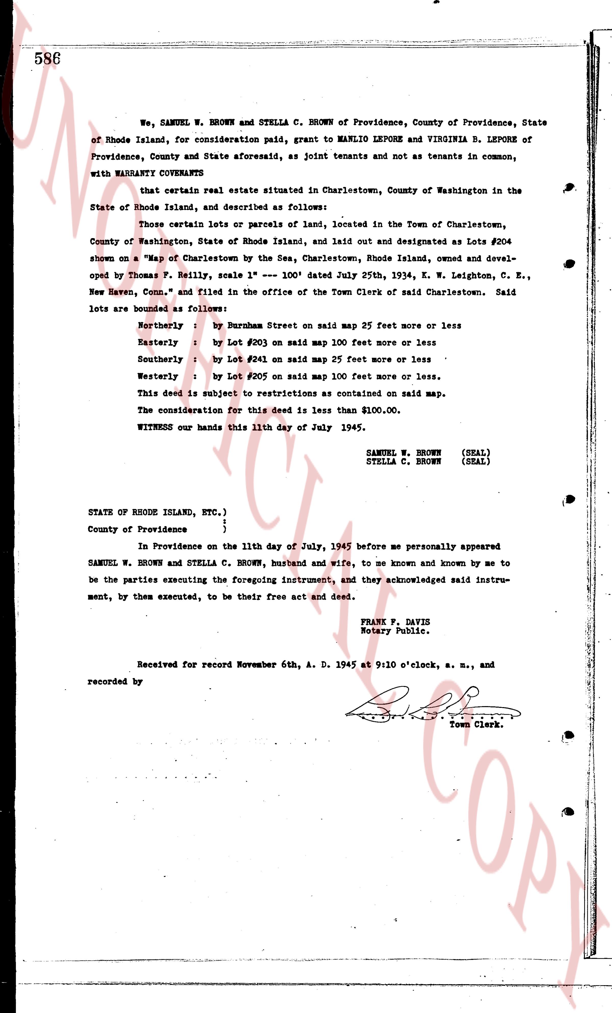
We, SAMUEL W. BROWN and STELLA C. BROWN of Providence, County of Providence, State of Rhode Island, for consideration paid, grant to MANLIO LEPORE and VIRGINIA B. LEPORE of Providence, County and State aforesaid, as joint tenants and not as tenants in common, with WARRANTY COVENANTS
that certain real estate situated in Charlestown, County of Washington in the State of Rhode Island, and described as follows:
Those certain lots or parcels of land, located in the Town of Charlestown, County of Washington, State of Rhode Island, laid out and designated as Lots #204 shown on a "Map of Charlestown by the Sea, Charlestown, Rhode Island, owned and developed by Thomas F. Reilly, scale 1" --- 100' dated July 25th, 1934, E. W. Leighton, C. E., New Haven, Conn." and filed in the office of the Town Clerk of said Charlestown. Said lots are bounded as follows:
Northerly : by Burnham Street on said map 25 feet more or less
Easterly : by Lot #203 on said map 100 feet more or less
Southerly : by Lot #205 on said map 25 feet more or less
Westerly : by Lot #202 on said map 100 feet more or less.
This deed is subject to restrictions as contained on said map.
The consideration for this deed is less than $100.00.
WITNESS our hands this 11th day of July 1945.
SAMUEL W. BROWN (SEAL)
STELLA C. BROWN (SEAL)
STATE OF RHODE ISLAND, ETC.)
County of Providence {
}
In Providence on the 11th day of July, 1945 before me personally appeared SAMUEL W. BROWN and STELLA C. BROWN, husband and wife, to me known and known by me to be the parties executing the foregoing instrument, and they acknowledged said instrument, by them executed, to be their free act and deed.
FRANK F. DAVIS
Notary Public.
Received for record November 6th, A. D. 1945 at 9:10 o'clock, a. m., and recorded by [Signature]
Town Clerk.
The page as recorded