The instrument's own words
page 1 · read by Gemma vision
689
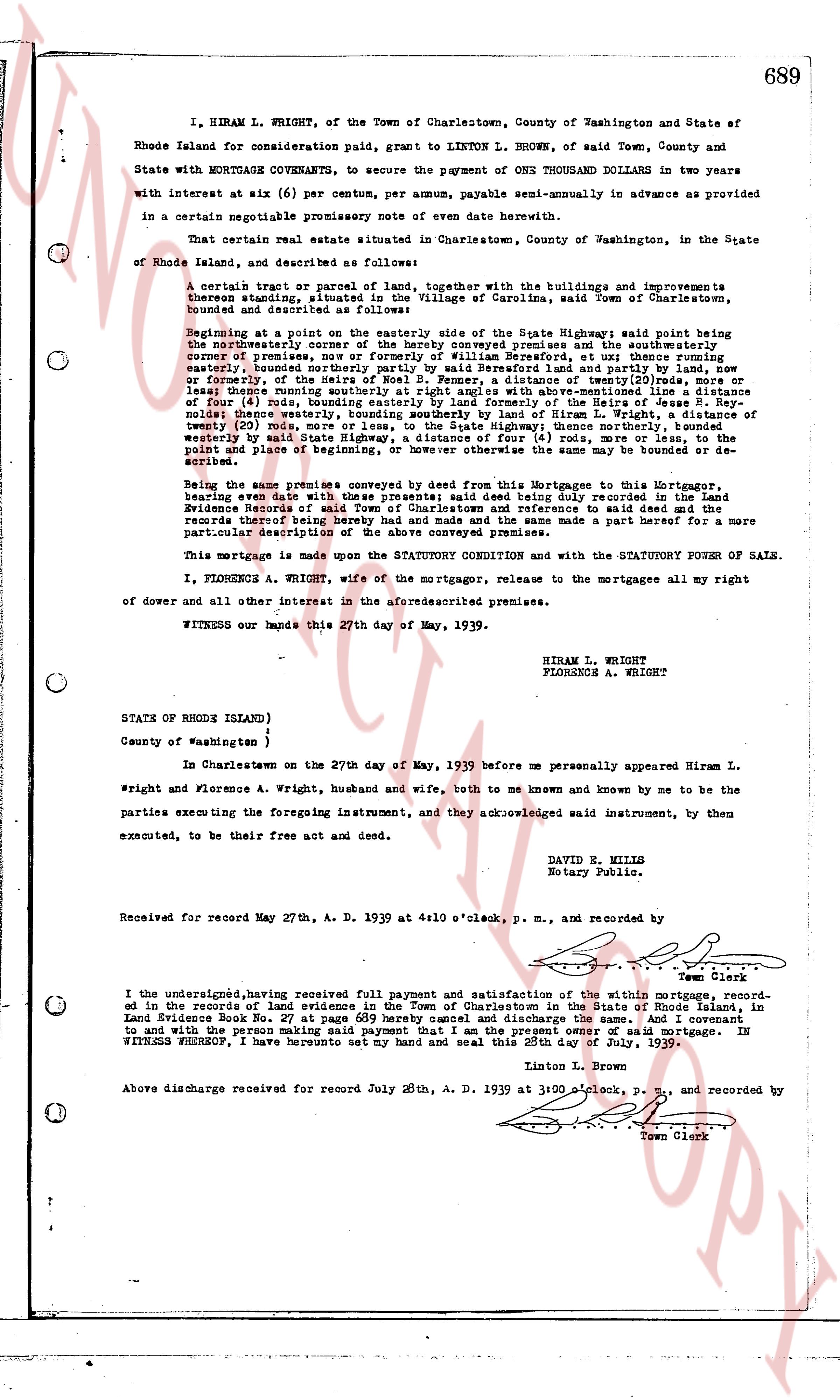
I, HIRAM L. WRIGHT, of the Town of Charlestown, County of Washington and State of Rhode Island for consideration paid, grant to LINTON L. BROWN, of said Town, County and State with MORTGAGE COVENANTS, to secure the payment of ONE THOUSAND DOLLARS in two years with interest at six (6) per centum, per annum, payable semi-annually in advance as provided in certain negotiable promissory note of even date herewith.
That certain real estate situated in Charlestown, County of Washington, in the State of Rhode Island, and described as follows:
A certain tract or parcel of land, together with the buildings and improvements thereon standing, situated in the Village of Carolina, said Town of Charlestown, bounded and described as follows:
Beginning at a point on the easterly side of the State Highway; said point being the northeasterly corner of the hereby conveyed premises and the southeasterly corner of a certain piece of land conveyed to Hiram L. Wright by deed of date June 1, 1934; thence running easterly, bounded northerly by said Beresford land and partly by land, now or formerly the property of the state of Rhode Island, and partly by land of others; thence running southerly at right angles to above-mentioned line a distance of 200 (two hundred) feet, running parallel to the line of the Highway; thence running westerly a distance of 20 (twenty) feet, bounded southerly by land of Hiram L. Wright; a distance of 20 (twenty) feet, more or less, to the State Highway; thence northerly bounded westerly by said State Highway a distance of 200 (two hundred) feet to the beginning point and place of beginning, or however else the same may be bounded or described.
Being the same premises conveyed by deed from this Mortgagee to this Mortgagor, bearing even date with these presents; said deed being duly recorded in the Land Evidence Books of said Town with reference to be had in said books and the records thereof being hereof made and the same made a part hereof for a more particular description of the above conveyed premises.
This mortgage is made upon the STATUTORY CONDITION and with the STATUTORY POWER OF SALE.
I, FLORENCE A. WRIGHT, wife of the mortgagor, release to the mortgagees all my right of dower and all other interest in the aforesaid premises.
WITNESS our hands this 27th day of May, 1939.
HIRAM L. WRIGHT
FLORENCE A. WRIGHT
STATE OF RHODE ISLAND)
County of Washington )
In Charlestown on the 27th day of May, 1939 before me personally appeared Hiram L. Wright and Florence A. Wright, husband and wife, both to me known and known by me to be the parties executing the foregoing instrument, and they acknowledged said instrument, by them executed, to be their free act and deed.
DAVID E. MILLS
Notary Public.
Received for record May 27th, A. D. 1939 at 4:10 o'clock, p. m., and recorded by [signature] Town Clerk
I the undersigned, having received full payment and satisfaction of the within mortgage, recorded in the records of Land Evidence of the Town of Charlestown in the State of Rhode Island, in Land Evidence Book No. 27 at page 689 hereby discharge the same and quit claim to and with the person making said payment that I am the present owner of said mortgage. IN WITNESS WHEREOF, I have hereunto set my hand and seal this 28th day of July, 1939.
Linton L. Brown
Above discharge received for record July 28th, A. D. 1939 at 3:00 o'clock, P. M., and recorded by [signature] Town Clerk
The page as recorded