The instrument's own words
page 1 · read by Gemma vision
156
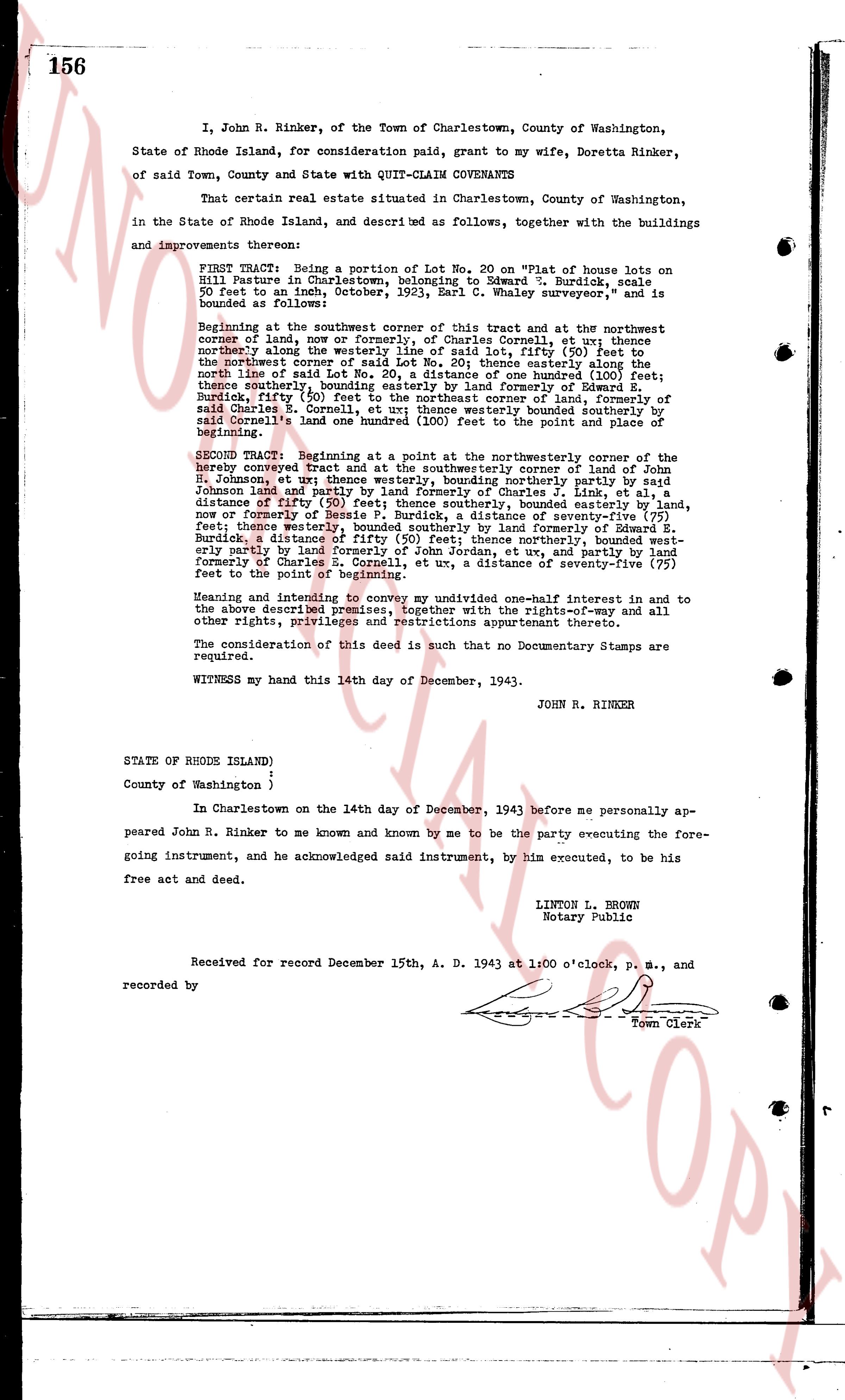
I, John R. Rinker, of the Town of Charlestown, County of Washington, State of Rhode Island, for consideration paid, grant to my wife, Doretta Rinker, of said Town, County and with QUIT-CLAIM COVENANTS
That certain real estate situated in Charlestown, County of Washington, in the State of Rhode Island, as described and as follows, together with the buildings and improvements thereon:
FIRST TRACT: Being a portion of Lot No. 20 on "Plat of house lots on Hill pasture in Charlestown, belonging to Edward T. Burdick, scale 50 feet to an inch, October, 1923, Earl C. Whaley surveyor," and is bounded as follows:
Beginning at the southwest corner of this tract and at the northwest corner of land of, now or formerly, of Charles Cornell, et ux; thence northerly along the west line of said Lot No. 20, said Lot, fifty (50) feet to the northeast corner of said Lot No. 20; thence easterly along the north line of said Lot No. 20, a distance of one hundred (100) feet; thence southerly, bounding easterly by land formerly of Edward T. Burdick, fifty (50) feet to the southeast corner of land of, now or formerly of said Charles E. Cornell, et ux; thence westerly bounded southerly by said Charles E. Cornell, one hundred (100) feet to the point of beginning.
SECOND TRACT: Beginning at the northwest corner of the northeasterly corner of hereby conveyed tract and at the southeasterly corner of land of John R. Johnson, et ux; thence westerly, bounding northerly formerly of Charles J. Link, et al, a distance of fifty (50) feet; thence northerly, bounding easterly by land formerly of John R. Johnson and partly by land formerly of Bessie P. Burdick, a distance of seventy-five (75) feet; thence westerly, bounding northerly by land formerly of E. T. Burdick, a distance of fifty (50) feet; thence northerly, bounded westerly partly by land formerly of Charles E. Cornell, et ux and partly remaining formerly of Charles E. Cornell, et ux a distance of seventy-five (75) feet to the point of beginning.
Meaning and intending to convey my undivided one-half interest in and to the above described premises, together with the rights-of-way and all other rights, privileges and restrictions appurtenant thereto.
The consideration of this deed is such that no Documentary Stamps are required.
WITNESS my hand this 14th day of December, 1943.
JOHN R. RINKER
STATE OF RHODE ISLAND )
)
County of Washington )
In Charlestown on the 14th day of December, 1943 before me personally appeared John R. Rinker to me known and known by me to be the party executing the foregoing instrument, and he acknowledged said instrument, by him executed, to be his free act and deed.
LINTON L. BROWN
Notary Public
Received for record December 15th, A. D. 1943 at 1:00 o'clock, P. M., and recorded by [?]
Town Clerk
The page as recorded