The instrument's own words
page 1 · read by Gemma vision
681
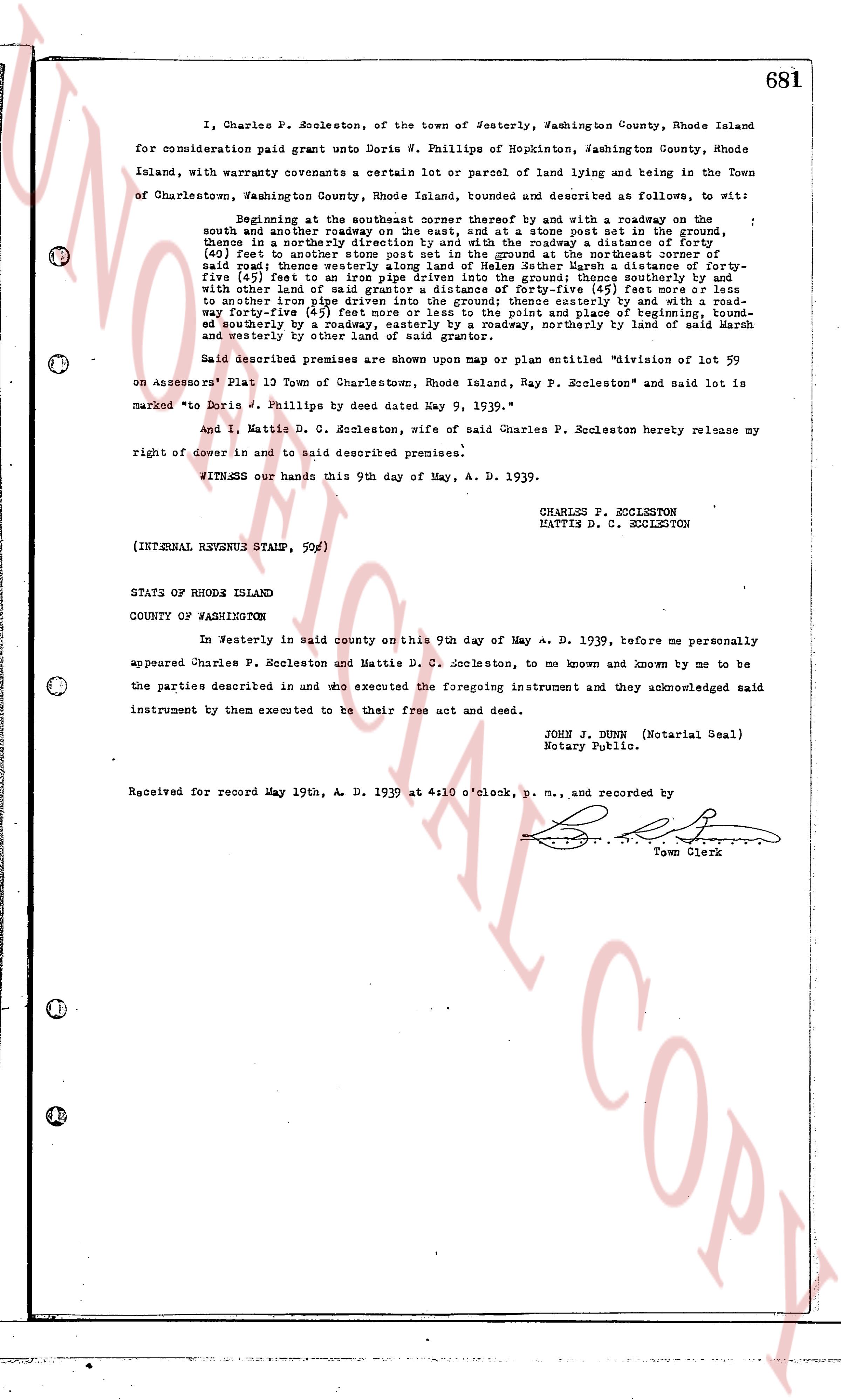
I, Charles P. Escoleston, of the town of Westerly, Washington County, Rhode Island
for consideration paid grant unto Doris W. Phillips of Hopkinston, Washington County, Rhode
Island, with warranty covenants a certain lot or parcel of land lying and being in the Town
of Charlestown, Washington County, Rhode Island, bounded and described as follows, to wit:
Beginning at the southeasterly corner between the roadway and sr a roadway on the
south and another roadway on the east, and at a stone post set in the ground, then
northerly in a northerly direction along said roadway a distance of 100 feet, then
(40) feet to another stone post set in the ground at the northeasterly corner of
said road, thence westerly along the line of said road a distance of 100 feet, thence
five (5) feet to an iron pipe driven into the ground; thence southerly and by
with other land of said grantor a distance of 100 feet, then easterly (5) feet
to an iron pipe driven into the ground; thence easterly and by with a road-
way for forty-five (45) feet to the point and place of beginning, bound-
ed southerly by a roadway running east to the point and place of beginning, bound-
ed northerly by with other land of said grantor, easterly, northerly by land of said March
and westerly by other land of said grantor.
Said described premises are shown upon map or plan entitled "division of lot 59
on Assessors' Plat 13 Town of Charlestown, Rhode Island, Ray P. Escoleston" and said lot is
marked "Doris W. Phillips by deed dated May 9, 1939."
And I, Mattie D. C. Escoleston, wife of said Charles P. Escoleston hereby release my
right of dower in and to said described premises.
WITNESS our hands this 9th day of May, A. D. 1939.
CHARLES P. ESCOLESTON
MATTIE D. C. ESCOLESTON
(INTERNAL REVENUE STAMP, 90c)
STATE OF RHODE ISLAND
COUNTY OF WASHINGTON
In Westerly in said county on this 9th day of May A. D. 1939, before me personally
appeared Charles P. Escoleston and Mattie D. C. Escoleston, to me known and known by me to
be the parties described in and who executed the foregoing instrument and they acknowledged said
instrument by them executed to be their free act and deed.
JOHN J. DUNN (Notarial Seal)
Notary Public.
Received for record May 19th, A. D. 1939 at 4:10 o'clock, p. m., and recorded by
[Signature]
Town Clerk
The page as recorded