The instrument's own words
page 1 · read by Gemma vision
443
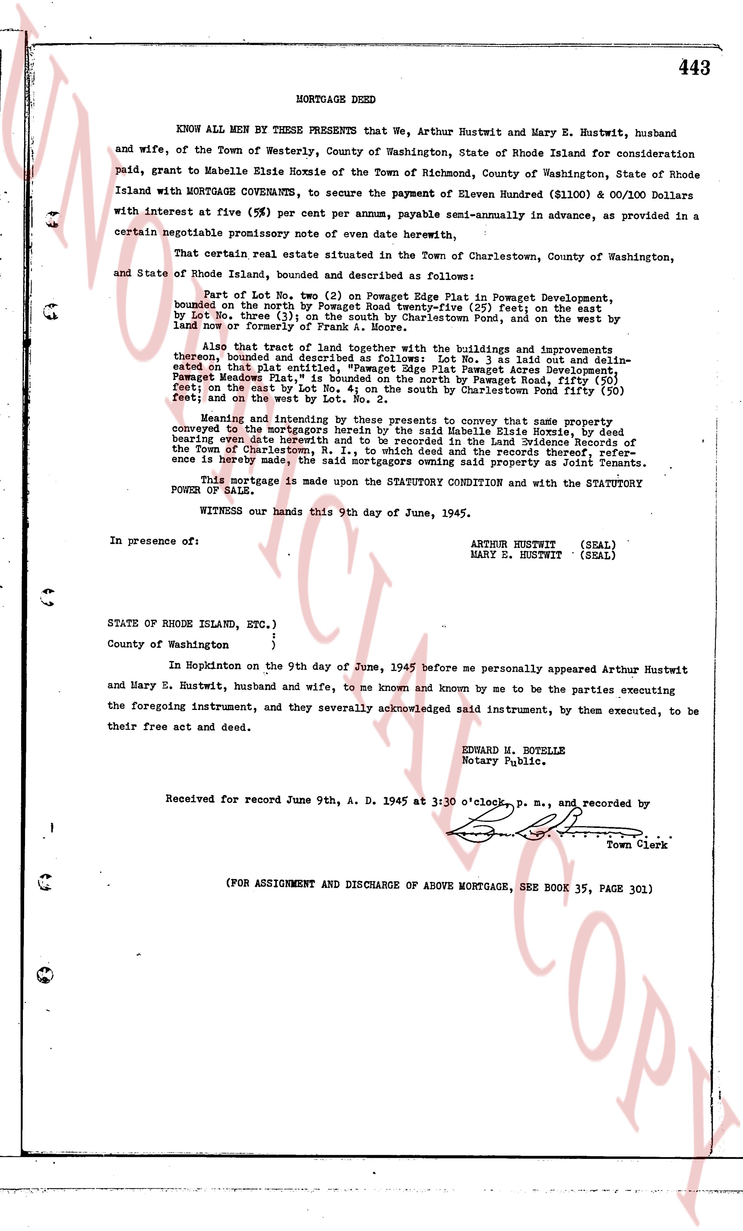
MORTGAGE DEED
KNOW ALL MEN BY THESE PRESENTS that We, Arthur Rustwit and Mary E. Hustwit, husband and wife, of the Town of Westerly, County of Washington, State of Rhode Island for consideration paid, grant to Mabelle Elsie Hoxsie of the Town of Richmond, County of Washington, State of Rhode Island with MORTGAGE COVENANTS, to secure the payment of Eleven Hundred ($1100) & 00/100 Dollars with interest at five (5%) per cent per annum, payable semi-annually in advance, as provided in a certain negotiable promissory note of even date herewith,
That certain real estate situated in the Town of Charlestown, County of Washington, and State of Rhode Island, bounded and described as follows:
Part of Lot No. two (2) on Pomeroy the Plat in Pawmet Development, bounded on the north by Pomeroy Road twenty-five (25) feet; on the east by Lot No. three (3); on the south by Charlestown Pond, and on the west by land now owned by Town of Charlestown.
also that tract of land together with the buildings and improvements thereon, bounded and described as follows: Lot No. 3 as laid out and delineated on that plat entitled "Pomeroy the Plat in Pawmet Development" also known as "Pawmet Meadows Plat", is bounded on the north by Pawmet Road, fifty (50) feet; on the east by the east line of the plat; on the south by Charlestown Pond fifty (50) feet; and on the west by Lot No. 2.
Meaning and intending by these presents to convey that said land and property conveyed on the Mortgage bearing date June 9th, 1945 to Mabelle Elsie Hoxsie Deed bearing even date herein and to be recorded in the Land Evidence Records of the Town of Charlestown, R. I., to which deed and the records thereof, reference is hereby made, the said Grantors owning said property as Joint Tenants.
This mortgage is made upon the STATUTORY CONDITION and with the STATUTORY POWER OF SALE.
WITNESS our hands this 9th day of June, 1945.
In presence of:
ARTHUR HUSTWIT (SEAL)
MARY E. HUSTWIT (SEAL)
STATE OF RHODE ISLAND, ETC.)
)
)
County of Washington )
In Hopkinton on the 9th day of June, 1945 before me personally appeared Arthur Hustwit and Mary E. Hustwit, husband and wife, to me known and known by me to be the parties executing the foregoing instrument, and they severally acknowledged said instrument, by them executed, to be their free act and deed.
EDWARD H. MOTELLE
Notary Public.
Received for record June 9th, A. D. 1945 at 3:00 o'clock, p. m., and recorded by
[Signature]
Town Clerk
(FOR ASSIGNMENT AND DISCHARGE OF ABOVE MORTGAGE, SEE BOOK 35, PAGE 301)
The page as recorded