The instrument's own words
page 1 · read by Gemma vision
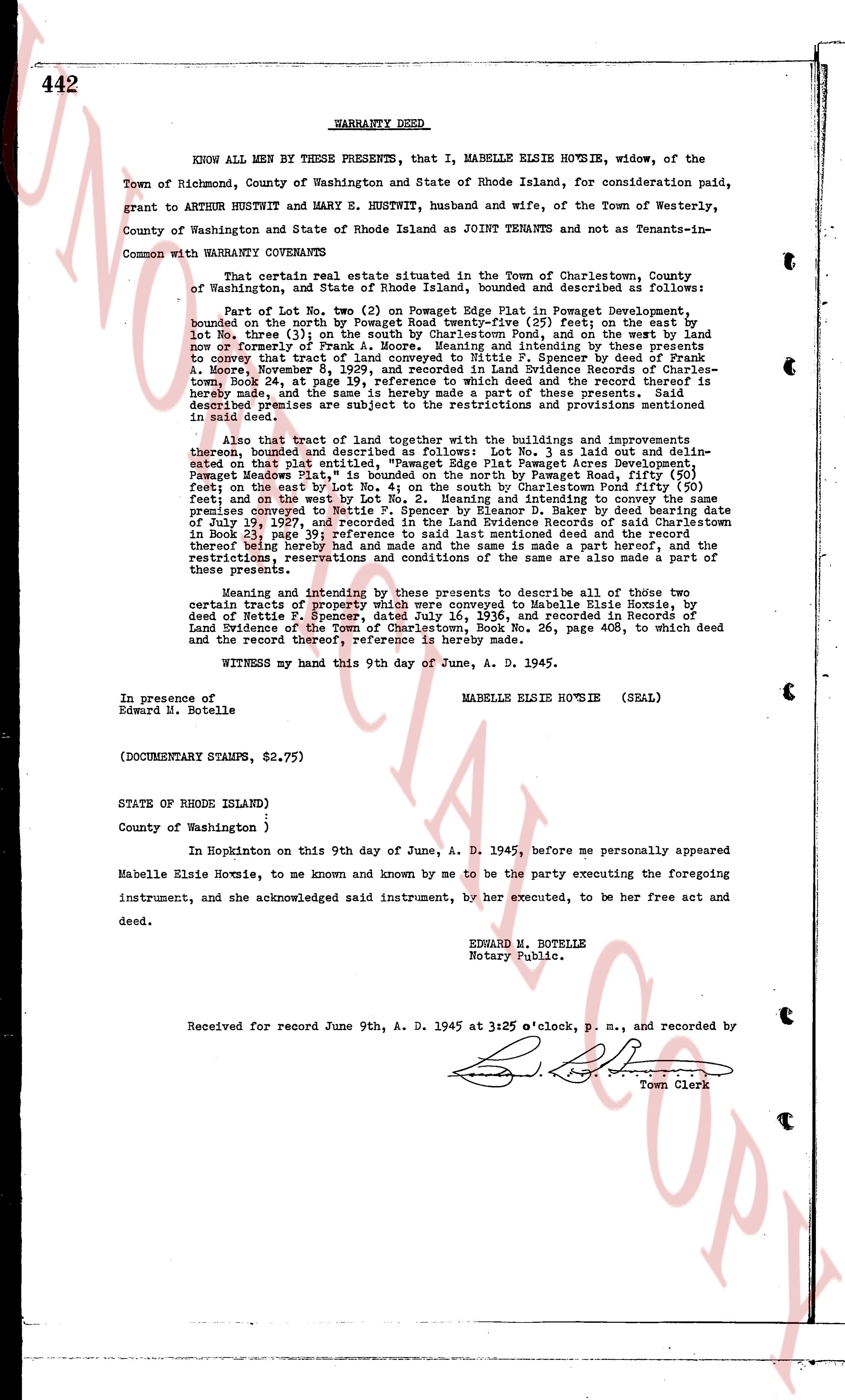
442 WARRANTY DEED
KNOW ALL MEN BY THESE PRESENTS, that I, MABELLE ELSIE HOXSIE, widow, of the Town of Richmond, County of Washington and State of Rhode Island, for consideration paid, grant to ARTHUR HUSTWIT and MARY E. HUSTWIT, husband and wife, of the Town of Westerly, County of Washington and State of Rhode Island as JOINT Tenants and not as Tenants-in-Common with WARRANTY COVENANTS
That certain real estate situated in the Town of Charlestown, County of Washington and State of Rhode Island, bounded and described as follows:
Part of Lot No. two (2) on Powegat Edge Plat in Powegat Development, bounded on the north by Powegat Road twenty-five (25) feet; on the east by Lot no. three (3) on the line between said Lot no. three and the land now or formerly of Frank A. Moore; Meaning and intending by these presents to convey that tract of land conveyed to me by deed from S. Sprague, by deed dated November 4, 1929, and recorded in Land Evidence Records of Charlestown Book 24, page 47, at page 19, reference to which deed and the restrictions and provisions hereby made, and the same are a part hereof, and the restrictions and provisions contained in said deed are subjects the restrictions of the restrictions and provisions mentioned in said deed.
Also that tract of land together with the buildings and improvements thereon, bounded and described as follows: Lot No. 3 as laid out and delineated on that plat entitled "Powegat Edge" Powegat development located in "Powegat Meadows Plat," is bounded on the north by Powegat Road, fifty (50) feet; on the east by Lot no. 4 on the line between Charlestown Road and the land fifty (50) feet; and on the west by Lot No. 2. Meaning and intending to convey the same tract of land conveyed to me by deed from S. Sprague, by deed dated and recorded on July 19, 1927, and recorded in the Land Evidence Records of said Charlestown in Book 23, page 191, reference to which deed and the restrictions and provisions thereof therefore being hereby had and made the same is a part hereof, and the restrictions, reservations and conditions of the same are also made a part of these presents.
Meaning and intending by these presents to describe all of those two certain tracts of property which were conveyed to Mabelle Elsie Hoxsie, by deed of Rustic F. Sprague, by deed dated 1927, and recorded in the Book of Land Evidence of the Town of Charlestown, Book No. 26, page 408, to which deed and the record thereof, reference is hereby made.
WITNESS my hand this 9th day of June, A. D. 1945.
MABELLE ELSIE HOXSIE (SEAL)
In presence of
Edward M. Botelle
(DOCUMENTARY STAMPS, $2.75)
STATE OF RHODE ISLAND)
County of Washington )
In Hopkinton on this 9th day of June, A. D. 1945, before me personally appeared Mabelle Elsie Hoxsie, to me known and known by me to be the party executing the foregoing instrument, and she acknowledged said instrument, by her executed, to be her free act and deed.
EDWARD M. BOTELLE
Notary Public.
Received for record June 9th, A. D. 1945 at 3:25 o'clock, p. m., and recorded by
[Signature]
Town Clerk
The page as recorded