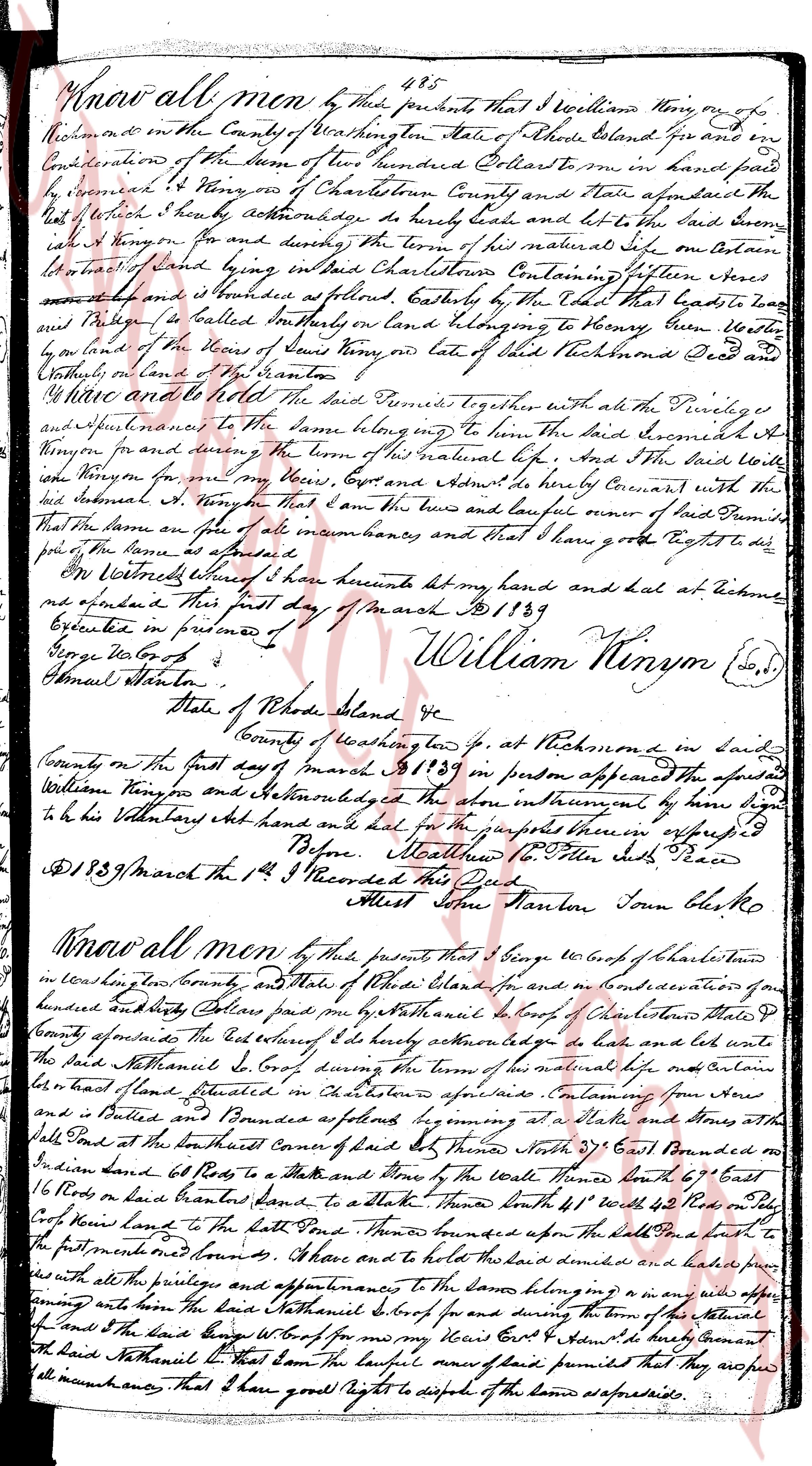
The instrument's own words
page 1
485
Know all men by these presents that I William Ninyon on of
Richmond in the County of Washington State of Rhode Island give and
in
Consideration of the Sum of two hundred Dollars to me in hand paid
by
George W Ninyon of Charlestown County and State aforesaid the
said
that whereas I hereby acknowledge to have Right and title to the said
said
I a Tenon for and during the term of its natural life on certain
of land lying in said Charlestown Containing five hundred Seven acres
more or less and bounded as follows Easterly by the land that leads to
and
Phillips as called boundary on lands belonging to Henry Brown Westerly
on the land of the heirs of Samuel Ninyon or to the title of the Richmond Deed and
Southerly on land of Henry Stanton.
And have and hold to the said land together with all the Privileges
and
appurtenances to the same belonging for the term said Samuel A
Ninyon in part during the term of its natural life And I the said Willi
am
Ninyon for me my heirs Cost and Assigns do hereby Covenant with the
said
Samuel A Ninyon that I am the true and lawful owner of said Premises
that the same are free of all incumbrances and that I have good right to do
just of the same as aforesaid.
In Witness whereof I have hereunto set my hand and seal at Richmond
and executed this first day of March A D 1839
George W Ninyon
Samuel Stanton.
William Ninyon (S.S)
State of Rhode Island
County of Washington fp. at Richmond in said
County on the first day of March A D 1839 in person appeared the foresaid
William Ninyon and Acknowledged the above instrument by him signed
to be his Voluntary act and deed and had and delivered for the purposes expressed
Before
Meathow to Other Side
[illegible]
A D 1839 March the 1st I Recorded this Deed
Asst Clerk Stanton Town Clerk sc
Know all men by these presents that I George W Cook of Charlestown
in Washington County and State of Rhode Island for and in consideration of one
hundred and fifty Dollars paid to me by Nathaniel S Cook of Charlestown State
of
County aforesaid the full receipt of which I hereby acknowledge to have and title to
the said Nathaniel S Cook during the term of his natural life on certain
of land situated in Charlestown aforesaid Containing one hundred acres
more
or less and bounded as follows beginning at a Stake and Stones at the
said
Stake on the South East corner of said land Then South 21° East bounded on
Indian land 68 Rods to a Stake and thence by the Wall of the Wall North 69° East
16
Rods to a Stake in road land bounded to a stake Then North 41° West 42 Rods to a Stake
of
Cooks land to the North fence Thence bounded upon the South by a brush to the
first monument here first. And have and hold the said land described and held together
with
all the privileges and appurtenances to the same belonging for the term said
and
after among the said Nathaniel S Cook for and during the term of his natural
life And I the said land Cook for me my heirs Cost & Assigns do hereby Covenant
that
said Nathaniel S that same the lawful owner of said Premises that they are free
of all incumbrances that I have good right to dispose of the land aforesaid.
The page as recorded