The instrument's own words
page 1 · read by Gemma vision
422
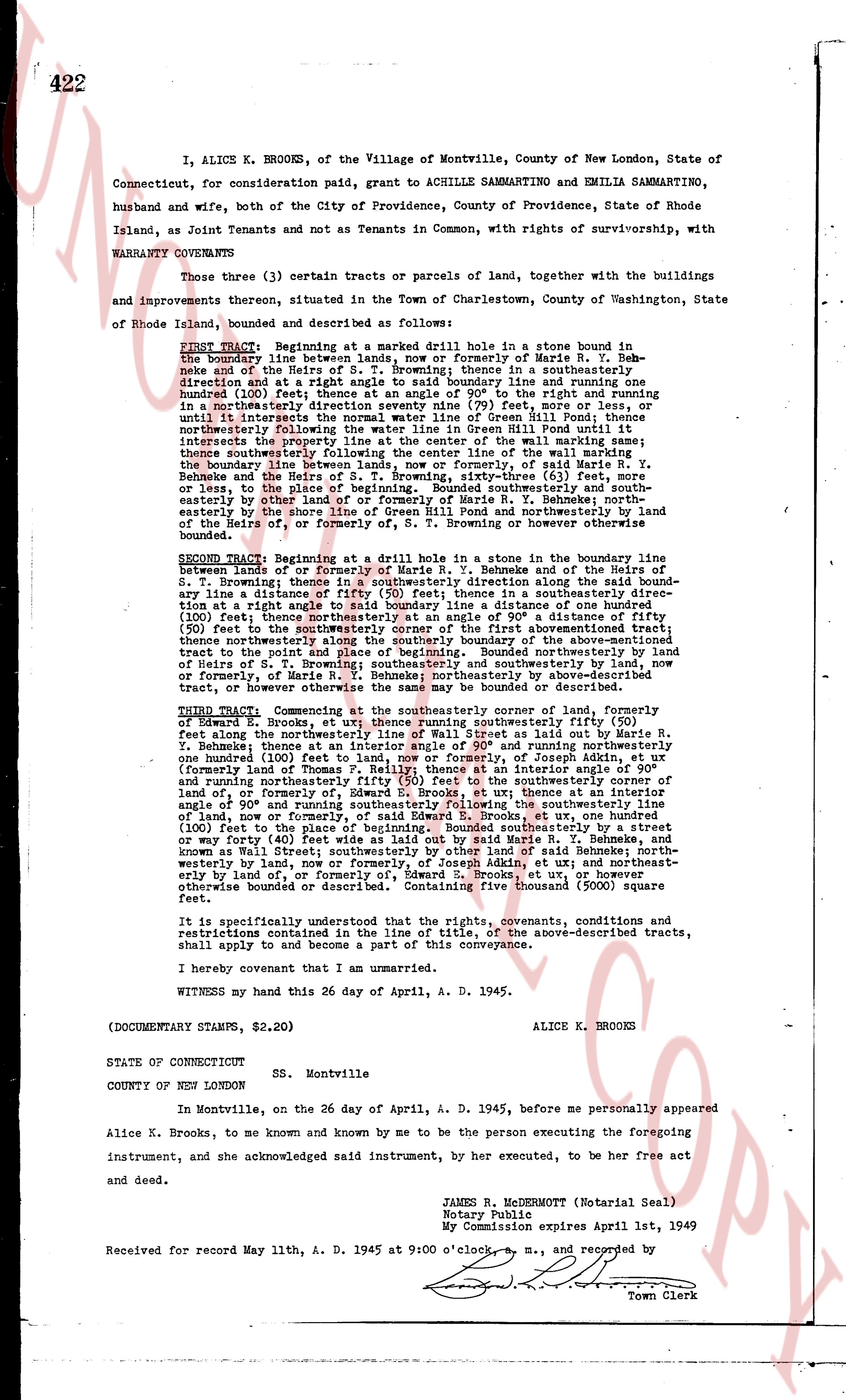
I, ALICE K. BROOKS, of the Village of Montville, County of New London, State of Connecticut, for consideration paid, grant to ACHILLE SAMMARTINO and EMILIA SAMMARTINO, husband and wife, both of the City of Providence, County of Providence, State of Rhode Island, as Joint Tenants and not as Tenants in Common, with rights of survivorship, with WARRANTY COVENANTS
Those three (3) certain tracts or parcels of land, together with the buildings and improvements thereon, situated in the Town of Charlestown, County of Washington, State of Rhode Island, bounded and described as follows:
FIRST Tract. Beginning at a marked drill hole in a stone bound in the boundary line between land of formerly or or formerly of Marie R. Y. Behnke and of the Heirs of S. T. Browning; thence in a southeasterly direction and at a right angle to said boundary line and running one hundreded (100) feet; thence turning ninety (90) deg to the right and running one hundreded (100) feet in a northeasterly direction seventy nine (79) feet, more or less, until it intersects the boundary line of the Green Hill Pond until it intersects the boundary line of the Green Hill Pond; thence easterly along the boundary line of the wall marking same; thence southeasterly following the center line of the wall marking the boundary line between land of formerly or or formerly of Marie R. Y. Behnke and the Heirs of S. T. Browning, sixty-three (63) feet, more or less, to the place where said wall turns southeasterly and southeasterly more or less to the place where said wall turns south and northerly between the land of the Heirs of, or formerly of, S. T. Browning or however otherwise bounded.
SECOND Tract. Beginning at a drill hole in a stone in the boundary line between land of formerly or of Marie R. Y. Behnke and of the Heirs of S. T. Browning; thence in a southeasterly direction along said boundary line a distance of eighty four (84) feet; thence in a southeasterly direction at a right angle to said boundary line a distance of one hundred (100) feet; thence northeasterly along the boundary of a 50' x 100' a distance of fifty (50) feet to the southeasterly corner of the first aforementioned tract; thence northeasterly along the boundary of the aforementioned tract to the point and place of beginning. Bounded northerly by land of Heirs of S. T. Browning; easterly and southerly by land now or formerly, or of Marie R. Y. Behnke; northeasterly by above-described tract, or however otherwise bounded or described.
THIRD Tract. Commencing at the southeasterly corner of land, formerly of Edward E. Brooks, et ux; thence running southeasterly fifty (50) feet; then along the southeasterly boundary of said land or land of Marie R. Y. Behnke; thence at an interior angle of 90° and running northeasterly one hundred (100) feet; thence turning 90° to the right and running northeasterly (formerly land of Thomas P. Reilly) thence at an interior angle of 90° and running northeasterly fifty (50) feet to the southeasterly boundary of land of or formerly of, S. T. Browning; thence at an interior angle of 90° and running southeasterly following the southeasterly line land of, or formerly of, S. T. Browning, to a stone at one hundred (100) feet to the place of beginning. Bounded southeasterly by a street now or formerly known as Wall Street; said Marie R. Y. Behnke and known as Wall Street; southwesterly by other land of said Behnke; northwesterly by land, now or formerly of Edward E. Brooks, et ux, and northeasterly bounded by land of, or formerly of, Edward E. Brooks, et ux or however otherwise bounded or described. This tract contains five thousand (5000) square feet.
It is specifically understood that all the rights, covenants, conditions and restrictions contained in the line of the above, above-described tracts, shall apply to and become a part of this conveyance.
I hereby covenant that I am an unmarried.
WITNESS my hand this 26 day of April, A. D. 1945.
(DOCUMENTARY STAMPS, $2.20) ALICE K. BROOKS
STATE OF CONNECTICUT Ss. Montville
COUNTY OF NEW LONDON
In Montville, on the 26 day of April, A. D. 1945, before me personally appeared Alice K. Brooks, to me known and known by me to be the person executing the foregoing instrument, and she acknowledged said instrument, by her executed, to be her free act and deed.
JAMES R. MACDERMOTT (Notarial Seal)
Notary Public
My Commission expires April 1st, 1949
Received for record May 11th, A. D. 1945 at 9:00 o'clock a.m., and recorded by
Town Clerk
The page as recorded